Dzo Jongo 6,250 m
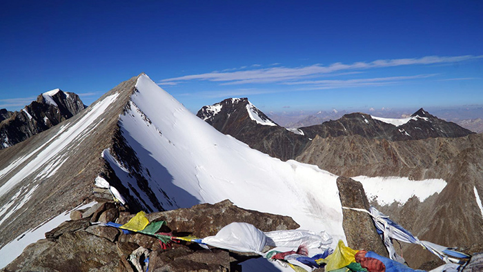
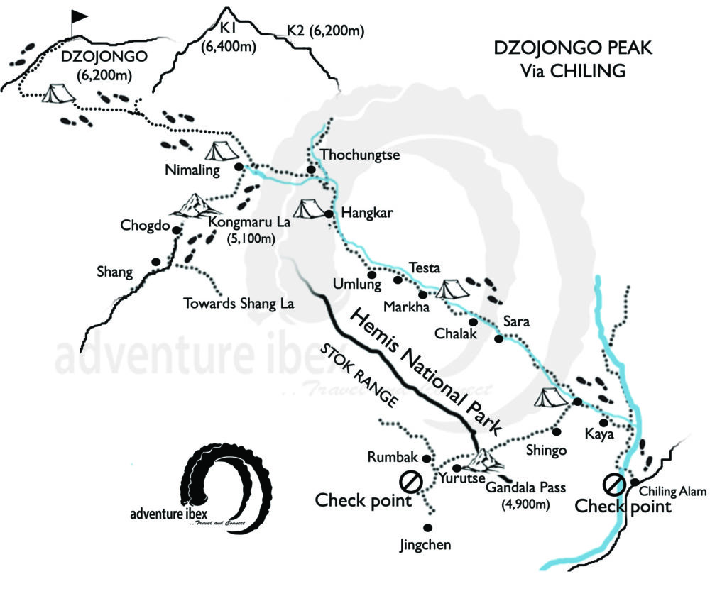
Dzo jongo peak (6,200 mts) lies just next to the mighty Kangyatse (6,400 mts). “Dzo” locally means a Hybrid of “Cow” and “Yak” . The reason for the name Dzo jongo came as the east and west peaks looks like the horns of the “Dzo”.Though its a trekking peak, still it requires at least basic knowledge about the climbing as it has some steep areas also and most important thing needed is a good health and a stamina. You can summit the Peak with either Kangyatse 1 or 2 or both in lesser time by trekking from Shang side, If you have time you can also do it from Markha valley side by taking enough time to acclimatize.
Best Time: June to Mid Sept. Grade: 3+
Itinerary
Day 1: Leh to Markha.
Drive to Markha village 3-4 hrs. It’s a very pleasant drive, up the Markha valley today with road along numerous streams. e. O/N at Camp
Day 2: Markha to Thoachungtse/Hangkar
From Markha the country changes and the warm, relatively heavily wooded sections of the lower Markha is left behind. We might need to cross the river several times as there are no bridges here. Hanker, en route, is the highest village in the Markha valley. O/N in Camp/ Home stay
Elevation Gain: 462 m
Elevation loss: -191 m
Total Distance: 11 Kms

Day 3: Thoachungtse/Hangkar to Base Camp of Kangyatse 2
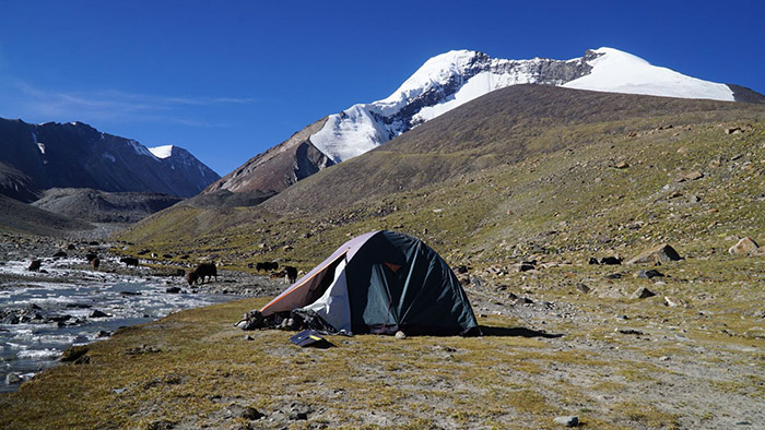
From Thoachungtse to the Base camp of the Kangyatse 2 is not that hard Journey as it will be almost flat towards the base. O/N at Camp
Elevation Gain: 1,423 m
Elevation loss: – 403 m
Total Distance: 9.83 Kms

Day 4: Thoachungtse to Nyimaling
Trek starts on a good path with several small inclines and a series of grassy ridges. There are a series of mani walls (walls carved with Buddhist prayers) and chortens en route. This is one of the most beautiful high valleys in Ladakh and is dominated by the Kangyatse peak. O/N in Camp/ Home stay
Elevation Gain: 1,045 m
Elevation loss: -233 m
Total Distance: 9.63 Kms

Day 5: Nimaling to Base Camp
We begin climbing the rocky slopes to our right after a half-hour stroll across Nimaling’s plain land. We continue walking straight towards a blind curve into the valley. From here on forth, the path is a series of massive ascending humps. To put it mildly, the mountain, which is covered in scree and loose rocks, is deceiving. Each time you reach one of the tops, you will be introduced to a new one. This stretch takes a long time to travel and changes colour with each new hump as the vista opens up to allow an ever-increasing panoramic panorama of mountain ranges in the region.
Elevation Gain: 459 m
Elevation loss: -52 m
Total Distance: 7.8 Kms

Day 6: Buffer day/Summit Push
Early in the morning at around 2;00AM,we will keep walking with little ascent for approx. 3-4 hrs.
We reached our first hard incline with a 60-65 degree gradient after 4-5 hours. This portion will require roping up and will take approximately two hours to complete. After we finish this part, we turn left into another steep climb of 80 degrees. This seemed extremely scary following the last incline. This portion will necessitate a permanent rope arrangement and the usage of our ascenders to traverse. The brief relief, though, is the arrival of daylight and, with it, a sense of warmth, which is sufficient to refuel our energies for the final ascent. This final section of the climb requires all of your motivation and strength.
After 8-12 hours, we will summit and enjoy the mesmerizing beauty with sunrise view from the top.
Ascend
Elevation Gain: 907m
Elevation loss: – 42.5 m
Total Distance: 4.8 Kms

Day 7: Summit Attempt to Nyimaling
Buffer Day
Day 8: Nyimaling to via Kongmaru la pass (5,100m) and Chogdo.
After breakfast start trekking to reach Kongmaru La (5100m). The trek to Kongmaru-La passes through narrow gorges. At the top of the pass, you can get the view of the Ladakh range and the villages of the Indus valley to the north. Cross the pass and proceed to Shang Chogdo and drive back to Leh.
Elevation Gain: 575 m
Elevation loss: -1,603 m
Total Distance: 13.6 Kms

Day 9: Departure
Package Includes
- Grade A Certified climbing guide
- Climbing gears like Rope, Crampon, Ice Axe, Helmet etc
- Cook & Porter
- Comfortable good quality tent.
- Adventure Insurance
- IMF Expedition fee
- Pick and drop by jeep to the starting and finishing point of the trek
- Stay in Leh on MAP
- Entry fee at the monasteries
- All time food will be served during the expedition
- Trekking and wildlife fee
- Camping fee
- Oxygen Cylinder
- Gloves
Package Excludes
- Sleeping Bags For minus 30 Degree (will be provided by us on demand)
- Sun Screen / Lotion
- Walking Sticks
- Down Jackets, Thermals
- Water Bottle
- Trekking/climbing shoes (with crampon grip)
- Hat,
- Flesh light
- Good quality warm Jackets.
- Beverages (alcoholic or non alcoholic)
- Tips
- Any sort of expenses arising due to anything medical or anything else
- Personal porter or pony
- Back pack & rain cover
- Walking stick Advisable if you are used to it
- Head torch 1 Nos. (Hand torch would be an alternative)
- Water bottle/Hydration pack
- Snacks Energy bars, dry fruits, electoral
- Personal Medical Kit consulted by your doctor
- Pair of Waterproof gloves
- Sun cap
- Woollen cap.
- Neck-gaiters. (Optional)
- Sunglass (U/V protected)
- Trek pants
- T-shirts Full sleeves
- Down Jacket
- Wind & waterproof jacket & pant 1 Pair
- Thermal inners 1 Pair
- Trekking shoes 1 Pair (Waterproof with grip for crampons)
- Floaters/flip-flops 1 Pair (Optional)
- Cotton socks 2 pairs
- Woollen socks 2 pairs
- Gumboots Required only for Chadar trek
- Sunscreen cream
- Hand sanitiser
- Moisturiser
- Antibacterial powder
- Lip balm
- Toothbrush and toothpaste
- Toilet Paper & wipes
- Quick dry towel


